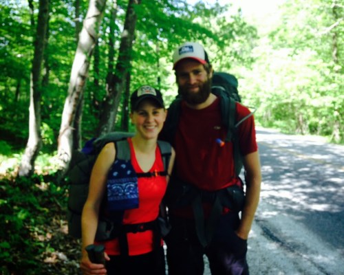
In 4 weeks I will start my thru-hike of the John Muir Trail (JMT). I’ve tried thru-hiking the Appalachian Trail, I’ve hiked sections of the Pacific Crest Trail, and I’ve even attempted to hike the JMT before. The JMT isn’t even part of the ‘triple crown‘ of hiking, and a lot of casual hikers haven’t even heard of the trail, so why would I choose to hike the JMT again as my next long-distance hike attempt?
“Thousands of tired, nerve-shaken, over-civilized people are beginning to find out that going to the mountains is going home; that wildness is a necessity” ― John Muir, Our National Parks
The John Muir Trail is a 211-mile long trail that runs parallel to the Sierra Nevada mountain range in California, named for naturalist John Muir, a founding member and first president of the Sierra Club. It is located in the High Sierra backcountry and wilderness areas and follows the same footpath (for the most part) as the longer Pacific Crest Trail. The trail starts in the north at Happy Isles in Yosemite Valley, runs through Yosemite National Park, the Inyo and Sierra national forests (including the John Muir Wilderness and Ansel Adams Wilderness), passing through Devils Postpile National Monument, Kings Canyon National Park, and ends at the summit of Mount Whitney in Sequoia National Park. With an elevation gain of approximately 47,000 feet (14,000 m), the majority of the trail is at or above 8,000 feet (2,400 m) and about 35% of the trail, including the entirety of the last 30 miles (48 km), lie above 10,000 feet (3,000 m)(1).
The coniferous forests of the Yosemite Park, and of the Sierra in general, surpass all others of their kind in America, or indeed the world, not only in the size and beauty of the trees, but in the number of species assembled together, and the grandeur of the mountains they are growing on. – John Muir, Our National Parks
So, Why hike the JMT?
- The trail passes through some of the most beautiful and iconic alpine and high mountain scenery (it does pass through the Ansel Adams Wilderness, an area named in honor of Ansel Adams, well-known environmentalist and nature photographer who is famous for his black and white landscape photographs of the Sierra Nevada)
- It passes through 3 National Parks and 2 National Forests
- It can be hiked in its entirety in as little as 14 days (although most people plan for 3 weeks to complete it, I will be going at a leisurely pace and expect to finish it in 32 days)
- There are thousands of lakes offering premium camping almost every single night!
- Jagged peaks, deep canyons, and granite cliffs offer an otherworldly experience
- Apparently, the John Muir Trail is blessed with the mildest, sunniest climate of any significant mountain range in the world
- Given the previous three points, the sunrises are transcendent!
- It is a true wilderness adventure, far removed from civilization, known for its relative solitude (although the main entry points (mostly the termini) for the trail can be quite crowded and the trail is restricted to access via permit only)
- You can become truly disconnected. The JMT is one of the few places in the world where cell phones don’t work, and you will be entirely off the grid
- Because the trail is so remote and civilization is so far away, there is absolutely no light pollution at night. This is an astronomer’s/stargazer’s paradise
- If you are a photographer, there are breathtaking mountains and unparalleled vistas to create a stunning portfolio that exhibits the grandeur and beauty of one of the most impressive natural places on the planet
- You will have bragging rights to say you climbed the highest mountain in the contiguous United States, which is Mount Whitney at a staggering 14,505 ft!
- With an elevation gain of about 47,000ft, you can also claim that you hiked the equivalent of Mt. Everest 1 ½ times!
- You will be in AWESOME shape by the time you complete the trek. Think of this as the ultimate workout!
- It’s one epic and very achievable adventure!(2)
- If all of the above isn’t enough to convince you, this short video by The Muir Project may help.
Of all the mountain ranges I have climbed, I like the Sierra Nevada the best. – John Muir, Our National Parks
Notes and References:
(1) – The John Muir Trail on Wikipedia – https://en.wikipedia.org/wiki/John_Muir_Trail
(2) – Although hiking the JMT is very doable, it does take serious planning and consideration. Do not endeavor to hike this trail without adequate preparation, as it is a TRUE WILDERNESS expedition that needs to be planned carefully in order to be completed safely. Many things need to be taken into consideration such as meal planning, resupplies, and altitude sickness (just to name a few).
Resources:
- The Hassle-Free JMT Permit Application – This post offers a hassle-free step-by-step guide for obtaining a permit to hike on one of the most iconic trails in the United States. These instructions pertain to a northbound (NOBO) route starting at Horseshoe Meadow, hiking over Cottonwood Pass Trail then up the Pacific Crest Trail (PCT) until you intersect the JMT.
- The John Muir Trail and Thru-Hike Planning – An Excel Workbook to Plan Your Hike! – You can now download my JMT Hike Planning Workbook, a comprehensive planning tool that includes worksheets for itineraries, logistics, resupplies, costs, food selection lists, food ordering lists, food schedules, and gear lists.